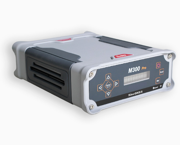
M300 Pro GNSS Receiver
Features
- GPS:L1/L2/ L5, BeiDou B1/B2/B3, GLONASS:L1/L2, Galileo, QZSS
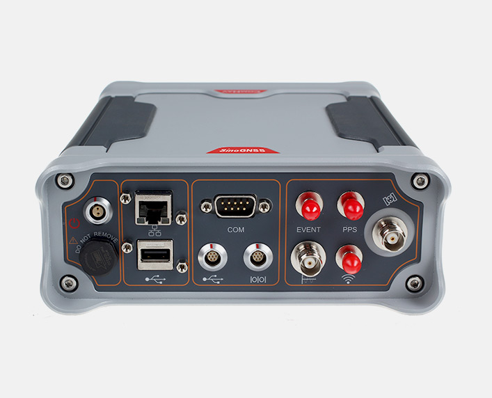
- Compact housing with flexible interfaces for external devices
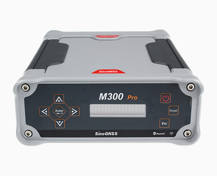
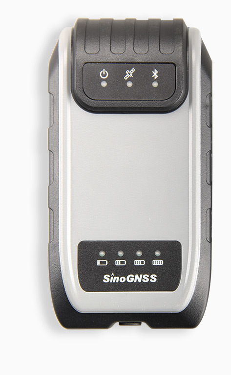
- User-friendly front panel display and configuration
- Full remote control with powerful built-in webserver
- Large capacity internal memory and expendable memory
- Integrated battery serves as a primary power or an UPS
All GNSS constellations on track
Proven design
Ideal for reference station
Powerful remote control
Technical specifications
- Signal Tracking
- Positioning Specifications
- Communications
- Data Format
- Data Logging
- Physical
- Environmental
- Electrical
- User Interface
| Signal Tracking | |
| Channels | 496 channels |
| GPS | L1 C/A, L1P, L2C, L2P, L5 |
| BeiDou | B1, B2, B3 |
| GLONASS | L1 C/A, L1P, L2 C/A, L2P |
| Galileo | Reserved |
| QZSS | Reserved |
| SBAS | WAAS, EGNOS, MSAS, GAGAN |
| Time Precision | |
| GPS+Glonass+Beidou | 20ns |
| Positioning Specifications | |
| Post Processing Static
(Long Observation) |
3 mm+0.1 ppm Horizontal
3.5 mm+0.4 ppm Vertical |
| Single Baseline RTK
(<30km) |
8 mm + 1 ppm Horizontal
15 mm + 1 ppm Vertical |
| Network RTK | 8 mm + 0.5 ppm Horizontal
15 mm + 0.5 ppm Vertical |
| E-RTK (<100km) | 0.2m + 1 ppm Horizontal
0.4m + 1 ppm Vertical |
| DGPS | <0.4 m 3D RMS |
| SBAS | 1 m 3D RMS |
| Standalone | 1.5 m 3D RMS |
| Communications | |
| Communication ports | 3 Lemo Ports
1 DB9 male port: Standard RS232 protocol 1 Standard USB port: Connect with external storage card 1 RJ45 LAN Ethernet port (10/100M Bit) 3 SMA male connectors 2 TNC connectors |
| Protocol | HTTP, TCP/IP, FTP, NTRIP |
| PPS | 1 Pulse Per Second Output |
| Event marker | Event marker input |
| Data Format | |
| Correction data I/O | RTCM 2.X, 3.X, CMR(GPS only), CMR+(GPS only) |
| Positioning data outputs | – ASCII: NMEA-0183: GSV, RMC, HDT, VHD, GGA, GSA, ZDA, VTG, GST, PJK, PTNL
– Extended NMEA-0183: BDGGA, GPNTR, GPCDT, GPHPR |
| Observations | ComNav binary, BINEX, RTCM3.X, compatible with major CORS software (VRS, FKP and iMax) |
| Data Logging | |
| Loop recording function | support |
| Simultaneously raw data recording | Five |
| Storage capacity | 8 GB internal memory
Maximum 1TB external memory |
| File format | RINEX 3.X, 2.X or ComNav binary format |
| File log | 5\10\15\20\30min or 1\2\4\24hour
Maximum 50Hz data logging rate |
| Data retrieval and transfer | FTP and USB |
| Physical | |
| Size(L×W×H) | 202mm x 163mm x 75mm |
| Weight | 2.4 kg |
| Housing | Rugged aluminum housing |
| Environmental | |
| Working temperature | -40 °C to +80 °C |
| Storage temperature | -45℃ to +85℃ |
| Humidity | 100% no condensation |
| Water proof and dust proof | IP67, survives the temporary immersion to a 1 m depth |
| Shock | Rugged aluminum case with rubber ring seal, designed to survive a 1m drop onto concrete |
| Electrical | |
| Power consumption | 3.5 W |
| External power input | 9.5-28 VDC, with over-voltage protection |
| Power supply | Integrated internal battery 7.4 V, 17600mAh, Li-ion; 16-hour continuously working |
| User Interface | |
| Front Panel Display | 4 arrow keys and data entry
Power button, Reset button and Esc button LCD display showing receiver’s status |
| WebServer | ComNav M300 Pro Web Server |
| Software | CRU software |
More products from the category
High accuracy GNSS technology