T300 Plus GNSS Receiver
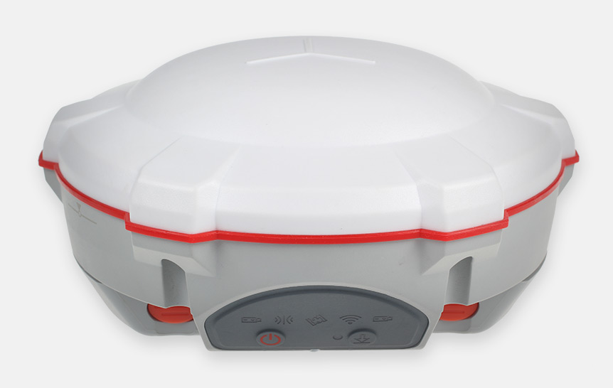
The T300 Plus GNSS Receiver is a new generation RTK receiver featuring full-constellation tracking, tilt compensation and easy workflow with Android-based Survey Master software, for centimeter accuracy survey on demand.

Features
-
GPS L1/L2/L5, BeiDou B1/B2/B3, GLONASS L1/L2, Galileo E1/E5a/E5b
-
Advanced QUANTUM Technology
-
WIFI/UHF/4G Module
-
Tilt Compensation
-
Smart Battery Design
-
Low Power Consumption
-
Support Long Baseline E-RTK

Tilt sensor
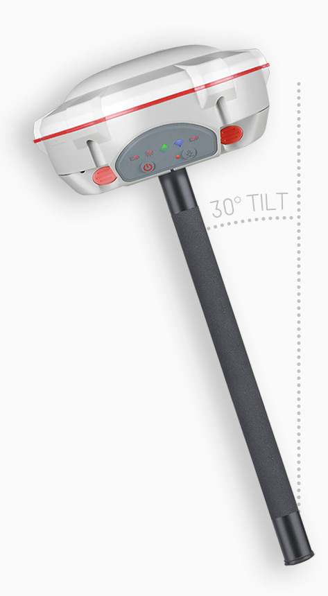
The T300 Plus supports up to 30° tilt compensation that allows you collect high accuracy data faster in the field.
Integrated and compact design
SinoGNSS T300 Plus combines a GNSS board, Bluetooth® and adjustable TX&RX UHF, WIFI and 4G modem into one rugged device for demanding surveying tasks. Its built-in 4G modem ensures the T300 Plus perfectly works with all kinds of CORS worldwide. Moreover, T300 Plus built-in tilt sensor supports maximum 30 ° pole tilt and keep the compensation accuracy within 3 centimeters, and you can check electronic bubble on the controller for fast survey in the field.
Flexibility for field use
Integrated a full-frequency UHF range from 410 to 470 MHz with its 12.5 KHz frequency interval, the T300 Plus is compatible with other radios and flexible for you to select different frequencies based on specific requirements. The built-in TX/RX UHF also enables your flexibility for base or rover option. For Radio router function, the T300 Plus is able to transmit correction data from the base to other rovers to expand working ranges in the fields.
Smart battery design
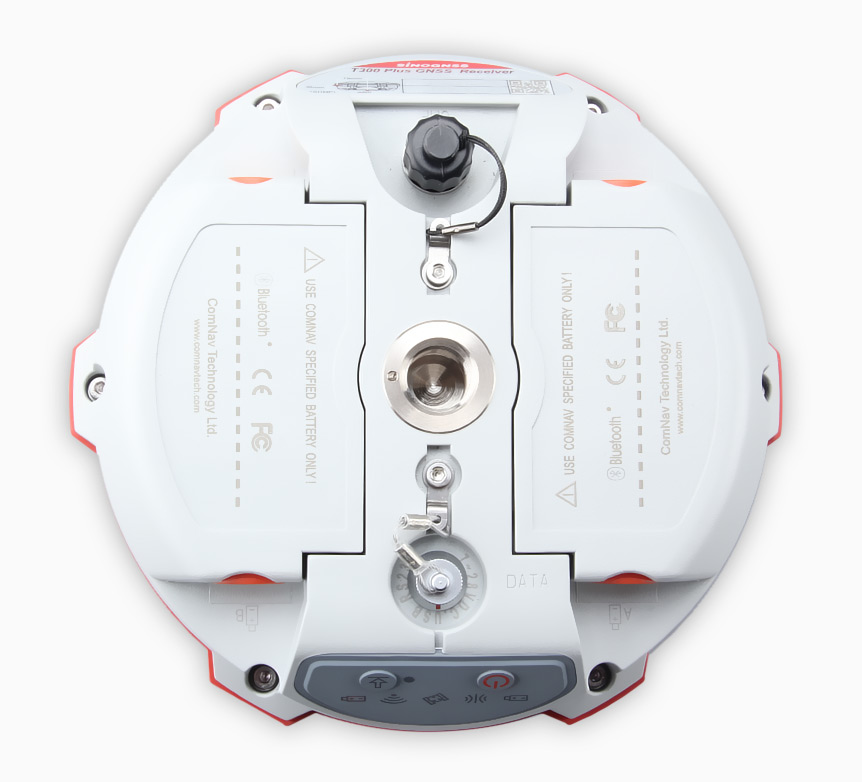
With two hot swap batteries, the T300 Plus helps to extend working hours and ensures you fluent workflow in the field. The battery LEDs flash when battery shortage, then you can replace batteries or directly charge in T300 Plus through an external power. Moreover, you will benefit from its consumer-grade battery design, compatible with Canon LP-E6, which is easy to purchase and replace in your local market.
Technical specifications
- Signal Tracking
- Performance Specifications
- Positioning Specifications
- Communications
- Data Format
- Physical
- Environmental
- Electrical
- Software
| Signal Tracking | |
| Channels | 572 |
| GPS | L1, L2, L2C, L5 |
| BeiDou | B1, B2, B3 |
| GLONASS | L1, L2 |
| Galileo | E1, E5a, E5b |
| QZSS | Reserved |
| SBAS | WAAS, EGNOS, MSAS, GAGAN |
| Performance Specifications | |
| Cold start | <50s |
| Warm start | <30s |
| Hot start | <15s |
| Initialization time | 10s |
| Signal re-acquisition | <1.5s |
| Initialization reliability | Typically>99.9% |
| Positioning Specifications | |
| Post Processing Static | Horizontal: 2.5 mm + 1 ppm RMS Vertical: 5 mm + 1 ppm RMS |
| Real Time Kinematic | Horizontal: 8 mm + 1 ppm RMS Vertical: 15 mm + 1 ppm RMS |
| E-RTK (<100km) | Horizontal: 0.2 m + 1 ppm RMS Vertical: 0.4 m + 1 ppm RMS |
| DGPS | < 0.4 m RMS |
| SBAS | 1 m 3D RMS |
| Standalone | 1.5 m 3D RMS |
| Communications | |
| Communication port | 1 x 7 pin lemo port (Combined Serial and USB function) Baud rates up to 921600bps for serial |
| Radio modem | Tx/Rx with full frequency range from 410-470 MHz Transmit power: 0.5-2W adjustable Range: 1-5km |
| WIFI/4G modem | 4G Bands: 800/900/1800/2100/2600 MHz 3G Bands: 900/2100 MHz 2G Bands: 900/1800 MHz Support GSM, Point to Point/Points and NTRIP |
| Positioning data outputs | 1HZ, 2HZ, 5HZ, 10HZ, 20HZ |
| Indicating light | 5 LEDs (indicating Power, Satellite Tracking, GPRS Status and Differential Data) |
| Bluetooth® | V 4.0 protocol, compatible with Windows OS and Android OS |
| Sensor | Tilt sensor |
| Data Format | |
| Data inputs/outputs | Correction data I/O: RTCM2.x, 3.x,CMR(GPS only), CMR+(GPS only) |
| Position data outputs | ASCII: NMEA-0183 GSV, RMC, HDT, VHD, GGA, GSA, ZDA, VTG, GST, PJK, PTNL ComNav Binary update to 20Hz |
| Physical | |
| Size(W×H) | 15.8cm×7.5cm |
| Weight | 0.95kg(include two batteries) |
| Environmental | |
| Operating temperature | -40 °C to +65 °C (40°F to +149°F) |
| Storage, temperature | -40 °C to +85°C (40°F to +185°F) |
| Humidity | 100% non-condensing |
| Waterproof and dust proof | IP67 protected from temporary immersion to depth of 1 meter, floats |
| Shock | Survives a 2-meter drop on to concrete |
| Electrical | |
| Input Voltage | 5-27 VDC |
| Power consumption | 3.1 W(3 constellations) |
| Li-ion battery capacity | 2×2000 mAh, Up to 9 hours typically |
| Memory | 8 GB internal memory (16 GB and 32 GB is optional) |
| Software | |
| CGSurvey | ComNav’s field data collection software |
| Survey Master | ComNav’s Android-based field data collection software |
| FieldGenius (optional) | MicroSurvey’s FieldGenius field data collection software |
| SurvCE (optional) | Carlson’s field data collection software |

All rights reserved by GEOiNSTRUMENTS © 2021
High accuracy GNSS technology