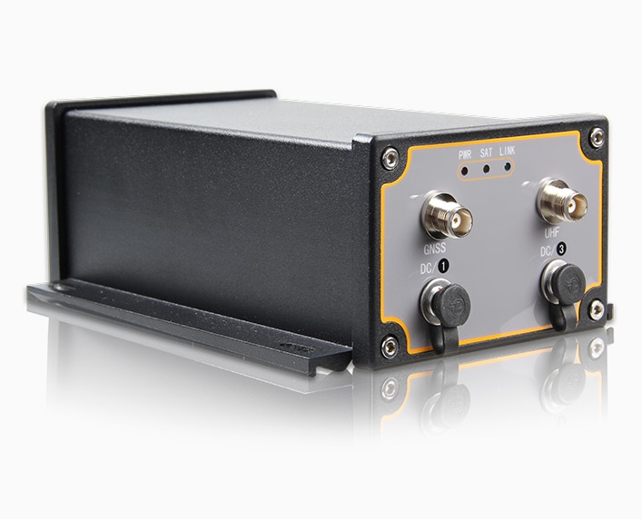
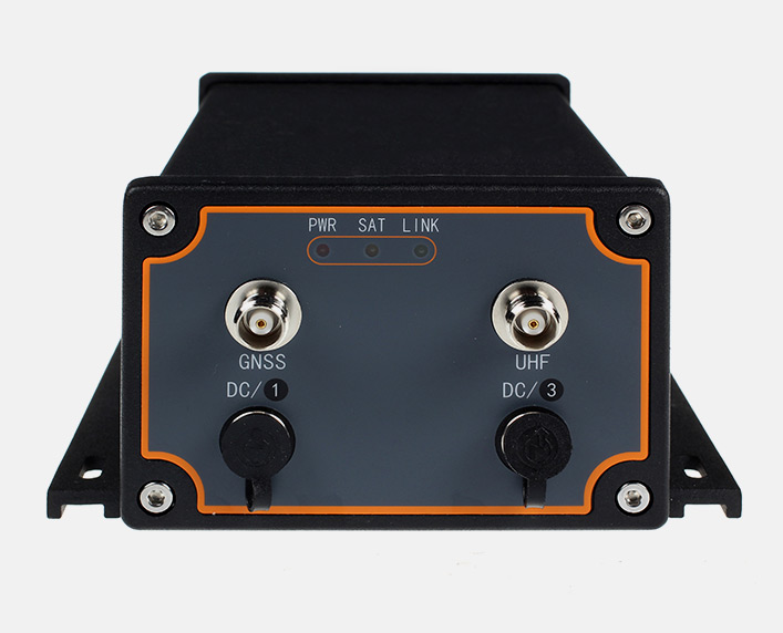
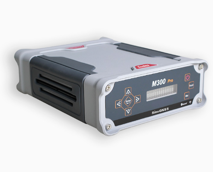
M300 GNSS Receiver
M300 is designed as the multi-purpose sensor for different kind of applications. With the powerful integration ability, M300 provides the solutions for geodetic reference station, deformation monitoring system, machine guidance, harbor construction, land surveying, marine surveying and other related high accuracy requested projects.
Features
- Support 1 PPS time data outputs
- GPS+BeiDou dual satellite system calculating
- Configurable GPS/BeiDou single system positioning and GPS+BeiDou dual system positioning
- Built in 2000V optoelectronic isolator, protect the receiver from lighting stroke
A ready to install device
The M300 is designed as a multi-purpose sensor for a range of applications. With its powerful integration ability, the M300 serves as a key part of a geodetic reference station, deformation monitoring system, machine guidance, harbor construction, land surveying, marine surveying or other high accuracy system.
Modular Design
Modular design makes M300 easily to integrate much more sensors for range of applications, such as radio/GPRS for RTK datalink, LAN port for internet connection.
GPS + BeiDou + GLONASS three constellation Technology
With its advanced dynamic acquisition ability and high accuracy carrier phase algorithms, the three constellation system high dynamic processing engine enhances the reliability and consistency of work in difficult and challenging environments such as land slide monitoring projects.
All in one device with correction signal reception
OEM card and UHF are integrated in a single enclosure. The M300 makes it easily to configure the output of data as required. Optional installation makes the M300 for multiple applications, for example the PPS output option makes it easy to use the M300 with 3D scanners.
Technical specifications
- Signal Tracking
- Performance Specifications
- Positioning Specifications
- Time Precision
- Communications
- Data Format
- Physical
- Environmental
- Electrical
- Antenna
- Software
| Signal Tracking | |
| Channels | 198 Channels |
| GPS | L1 C/A code, L1/L2 P code,L5 |
| BeiDou | B1, B2,B3 |
| GLONASS | L1,L2 |
| SBAS | WAAS, EGNOS, MSAS, GAGAN |
| Multipath mitigation | Advanced multipath mitigation technology |
| Low noise carrier phase | Measurement with<1 mm precision in a 1 Hz bandwidth |
| Performance Specifications | |
| Cold start | <50s |
| Warm start | <45s |
| Hot start | <15s |
| Initialization time | Typically < 10s |
| Signal re-acquisition | <2s |
| Initialization reliability | Typically > 99.9% |
| Positioning Specifications | |
| Post Processing Static | Horizontal: 2.5mm + 1ppm RMS
Vertical: 5mm + 1ppm RMS |
| Real Time Kinematics(RTK) | Horizontal: 10mm + 1ppm RMS
Vertical: 20mm + 1ppm RMS |
| E-RTK(baseline<100km) | Horizontal: 0.2m + 1ppm RMS
Vertical: 0.4m + 1ppm RMS |
| DGPS | <0.5m 3D RMS |
| SBAS | <1m 3D RMS |
| Standalone | <1.5m 3D RMS |
| Time Precision | |
| GPS+BeiDou+GLONASS | 20ns |
| Communications | |
| Communication Ports | 2 Serial ports(7 pin Lemo),1 receiving radio antenna port, 1 GNSS antenna port |
| Optional UHF | Internal Rx: 450-470 MHz
External Tx radio is available |
| Positioning data outputs | 1 Hz, 5 Hz & 10 Hz |
| PPS | 1 Pulse Per Second Output, Event marker input |
| Indicating light | 3 LEDs (indicating Power, Satellite Tracking and Differential Data) |
| LAN Port | 1 LAN Ethernet port |
| Data Format | |
| Correction data I/O | RTCM 2.x, 3.x, CMR (GPS only), CMR+(GPS only) |
| Positioning data output | ASCII: NMEA-0183 GSV, RMC, HDT, VHD, GGA, GSA, ZDA, VTG, GST, PJK, PTNL
Extended NMEA-0183 BDGGA, GPNTR, GPCDT, GPHPR ComNav Binary (compatible with major brands) |
| Physical | |
| Size(L×W×H) | 200mm×145mm×80mm |
| Weight | 1 kg (Include Internal UHF) |
| Case | Rugged and light high performance metal |
| Environmental | |
| Working temperature | -40℃ to +70℃ |
| Storage temperature | -45℃ to +80℃ |
| Humidity | 100% condensation |
| Waterproof and dust proof | IP67, can float on the water |
| Shock | survives a 2-meter drop on to concrete |
| Electric | |
| External power input | 10.5-28 VDC |
| Power consumption | 2.5 W |
| Memory | 100MB |
| Antenna | |
| Geodetic Antenna | AT300 GNSS Geodetic Antenna |
| Choke Ring Antenna (optional) | AT500 GNSS Choke Ring Antenna(depending on the applications) |
| Software | |
| CRU | ComNav Compass Receiver Utility software |
More products from the category
All rights reserved by GEOiNSTRUMENTS © 2018
High accuracy GNSS technology
High accuracy GNSS technology