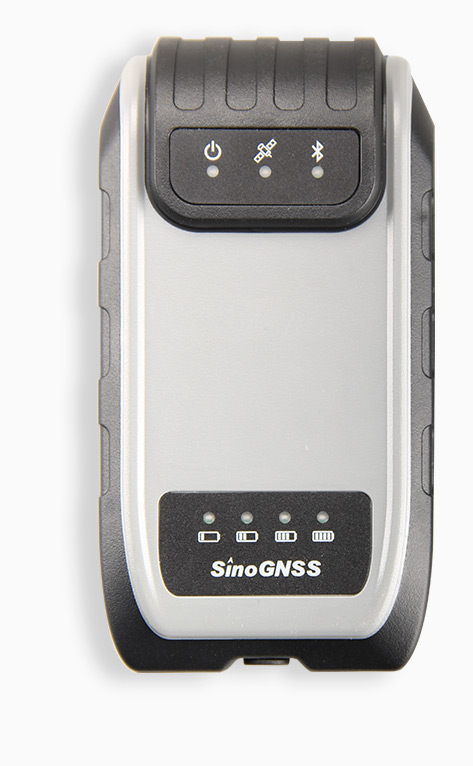
G100 GNSS Receiver
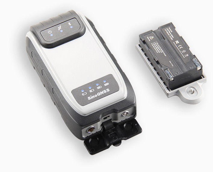
Designed for a wide range of GIS applications, such as power patrol, forestry survey, pipeline inspection, water management and other field work requiring a high level of precision, the G100 enables you collect reliable location data for daily GIS workflows. According to your working demands, the receiver can be mounted on a pole, carried in your pocket, or attached to a belt. The 3400 mAh battery provides up to 9 hour continuous operation, and fast charging design can save much of your time, enhancing efficiency and productivity in the field.
Features
- GPS L1, BeiDou B1, GLONASS L1,SBAS
- Sub-meter Positioning Accuracy
- Ideal for GIS Applications
- Compact Rugged Design
- Multiple Data Collection Device
- Choices via Bluetooth Connection
- Intergrated GNSS Antenna
Built to work the way you do
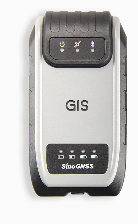
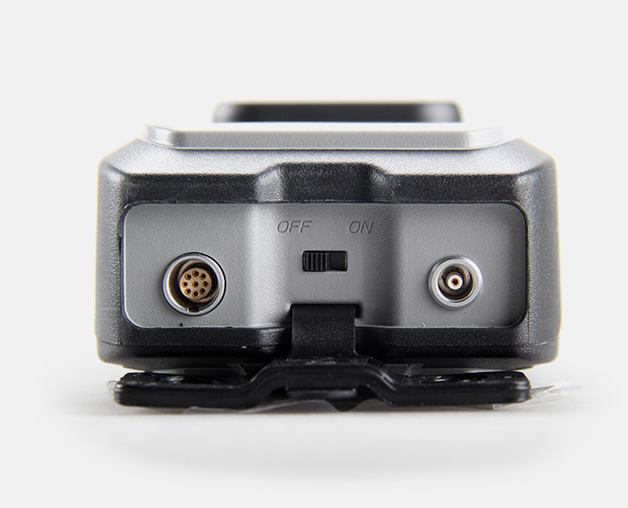
The G100 is a rugged, compact, wearable GNSS receiver that provides professional-level positioning data. With dimension of 137 mm × 72 mm × 50.4 mm and weighing less than 350 g, the G100 can go wherever you go. According to your working demands, the receiver can be mounted on a pole, carried in your pocket, or attached to a belt. Combined with an antenna and a single frequency OEM board that tracks multiple satellite constellations in a rugged case, the G100 receiver can deliver sub-meter accuracy to any connected devices to achieve great positioning performance in the field.
Enhanced bluetooth® connectivity
With the enhanced Bluetooth® connectivity – the G100 can be easily connected to devices with Android™ and Windows™ Mobile operating systems. It works well with SinoGNSS Survey Master software, it also ensures your GIS applications with existing third-party GIS software on your mobile device.
Smart battery design
The 3400 mAh battery provides up to 9 hour continuous operation, and fast charging design can save much of your time, enhancing efficiency and productivity in the field.
Ideal for GIS applications
Designed for a wide range of GIS applications, such as power patrol, forestry survey, pipeline inspection, water management and other field work requiring a high level of precision, the G100 enables you collect reliable location data for daily GIS workflows.
Technical specifications
| GNSS Features | |
| Channels | 200 channels |
| GPS | L1 |
| BeiDou | B1 |
| GLONASS | L1 |
| SBAS | WAAS, EGNOS, MSAS, GAGAN |
| Positioning Specification | |
| Post Processing | 2.5 mm + 1 ppm Horizontal 5 mm + 1 ppm Vertical |
| DGPS | <0.4 m 3D RMS |
| SBAS | 1 m 3D RMS |
| Standalone | 1.5 m 3D RMS |
| Communications | |
| Bluetooth | 4.0 |
| Protocol | Ntrip protocol (software based) |
| Physical | |
| Size(L×W×H) | 13.7cm × 7.2cm × 5.04cm |
| Weight | <0.35kg (including 1 battery) |
| Environmental | |
| Working temperature | -20°C to +60°C |
| Storage temperature | -30°C to +70°C |
| Dustproof/waterproof | IP54 |
| Shock and vibration | survive a 1.5m nature fall onto concrete |
| Power supply | |
| Battery capacity | 3400mAh |
| Power | 1.6w |
| Charging time | 2.5 h |
| Working time | Over 9 h continous work |
More products from the category
All rights reserved by GEOiNSTRUMENTS © 2018
High accuracy GNSS technology
High accuracy GNSS technology