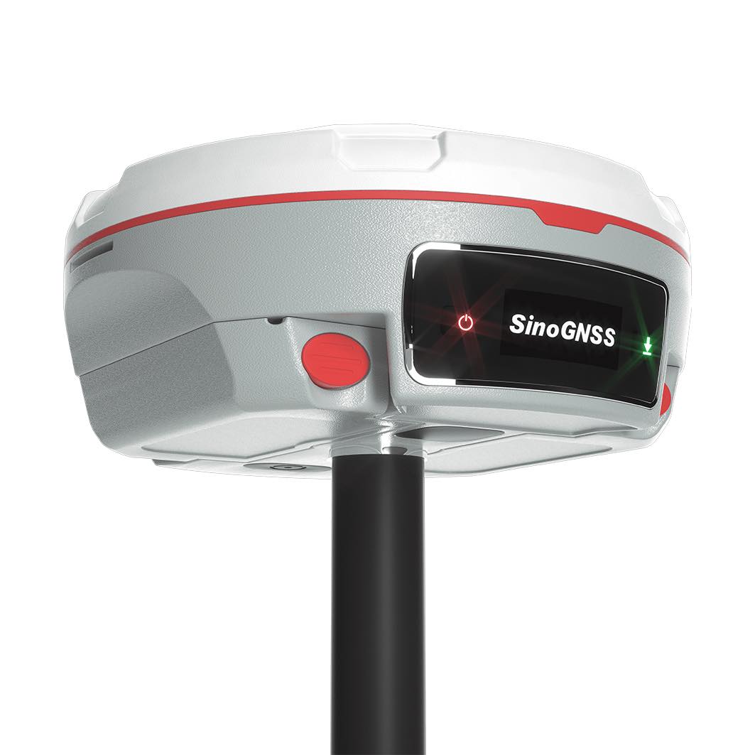
Mars Laser RTK
The Mars Laser RTK is an innovative GNSS receiver that integrates the most advanced GNSS, IMU, and laser technologies. It melds GNSS receiver and laser technology, shattering usual constraints in land survey, construction, and GIS applications. It ensures precision and minimizes user fatigue, crafting an impressive surveying experience. With this state-of-the-art RTK module, Mars Laser RTK will perform at its highest levels, making it the best choice for surveyors.
Video
Laser Technology
Mars’ precise laser replaces range poles in difficult conditions, enhancing work range and safety.This synergy of the GNSS receiver and laser module aligns well with surveyors’ usage habits, simplifying work in unique circumstances.
IMU
Mars boasts a 3rd generation built-in IMU sensor that detects minute accelerations from the laser point or range pole. Using advanced algorithms, it can maintain high precision with tilt compensation up to 60° in laser mode, simplifying field surveying and eliminating manual initialization.
New K8 Platform
Featuring 1590 channels and the ability to track more than 60 satellites, Mars is not just versatile, but also efficient by supporting SBAS PPP services. With its capability to achieve fixation within seconds, it significantly enhances productivity
Enhanced UHF
The integrated UHF transceiver module, built into the Mars device, boasts an impressively long operational range of up to 15 kilometers. Mars offers flexibility by allowing users to freely switch between rover and base modes.
Technical specifications
| Performance | |
| Channels | 1590 |
| GPS | L1C/A, L1C, L2P, L2C, L5 |
| BDS | B1I, B2I, B3I,B1C,B2a,B2b |
| GLONASS | G1, G2, G3 |
| Galileo | E1, E5a, E5b, E6c, E5 AltBOC |
| QZSS | L1C/A, L2C, L5, L1C |
| IRNSS | L5 |
| SBAS | L1C/A |
| Signal Recapture | ≤1s |
| RTK Initialization Time | <10s (Baseline≤10km) |
| Static and Fast Static | Horizontal 2.5 mm + 0.5 ppm RMS Vertical 5 mm + 0.5 ppm RMS |
| Single Baseline RTK | Horizontal 8mm + 1ppm RMS Vertical 15mm + 1ppm RMS |
| DGPS | <0.4m RMS |
| SBAS | Horizontal 0.5m RMS Vertical 0.8m RMS |
| Standalone | 1.5m 3D RMS |
| Laser Tilt Measurement | ≤5.5cm (5m range,≤60°Tilt in laser mode) |
| Physical | |
| Dimension | Φ 15.5cm x 7.3cm |
| Weight | 1.2kg with two batteries |
| Working Temperature | -40℃~+65℃ |
| Storage Temperature | -40℃~+85℃ |
| Humidity | 100% non-condensing |
| Waterproof and Dustproof | IP67 |
| Shock | Survive a 2m drop onto the concrete |
| Voltage | 7-28VDC |
| Power Consumption | 1.7W |
| Li-ion battery capacity | 2 x 3400 mAh |
| Memory | 8 GB |
| Battery life | ≥20h |
| Communication | |
| 1 Serial port (7 pin Lemo) | Baud rates up to 921,600 bps |
| Enhanced UHF modem | – Full frequency range: 410-470 MHz2 |
| – Transmit power: 0.5-2 W adjustable | |
| – Range: 15 km | |
| WIFI/4G modem |
– LTE-FDD: B1/B2/B3/B4/B5/B7/B8/B12/B13/B18/B19/B20/B25/B26/B28
|
| – LTE-TDD:B38/B39/B40/B41 | |
| – WCDMA: B1/B2/B4/B5/B6/B8/B19 | |
| – GSM: B2/B3/B5/B8 | |
| Position data output rates | 1 Hz, 2 Hz, 5 Hz, 10 Hz, 20 Hz |
| 5 LEDs |
indicating Satellites Tracking, RTK Corrections data, GPRS Status and Power
|
| Bluetooth |
V 4.0 protocol, compatible with Windows OS and Android OS
|
| Calibration-free IMU | Up to 60°tilt with 2.5 cm accuracy |
| Laser | |
| Range | 10m |
| Accuracy(room temperature) | (3-5)mm + 1ppm |
| Measuring Frequency | Classic Value: 3Hz Maximum Value: 5Hz |
| Laser Injection Power | 0.9mW~1.5mW |
| Working Temperature | -20℃~+50℃ |
| Storage Temperature | -30℃~+60℃ |

All rights reserved by GEOiNSTRUMENTS © 2018
High accuracy GNSS technology