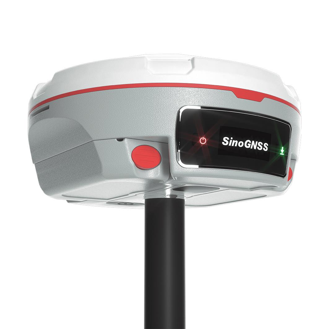
Mars Pro Laser RTK
The Mars Pro is an ultra-reliable GNSS receiver with a millimeter-level laser, enabling it to handle complex surveying tasks with unmatched precision, for example, in hard-to-reach, signal-obstructed, and dangerous fields. Mars Pro also features a sunlight-readable OLED color display for user-friendly, high-end operations. Breaking the usual constraints in land surveying, construction, and GIS, it is the go-to choice for professionals looking to elevate their work.
Video
Laser Technology
Mars Pro is outfitted with a laser of millimeter-level precision, serving as a viable substitute for a range pole during staking out and measuring, specifically in areas where it’s either unsafe or challenging for poles to access.
New K8 Platform
Equipped with the latest K8 platform, Mars Pro tracks 1668 channels for all running and existing constellations. Besides, new K8 platform has stronger computing capability and lower power consumption.
Enhanced OLED Display
The sunlight-readable OLED color screen that visually displays crucial information such as the number of satellites detected, fixed state, and power. This clear display allows surveyors to handle all their operations on screen freely.
Strong Compatibility
As the compatibility of datalink, Mars Pro is compatible with mainstream brands, support various protocols, including Transparent/TT450S/SATEL/Trimtakl3/CHC/South, so as to reach wider users.
Technical specifications
| Performance | |
| Channels | 1668 |
| GPS | L1C/A, L1C, L2P, L2C, L5 |
| BDS | B1I, B2I, B3I,B1C,B2a,B2b |
| GLONASS | G1, G2, G3 |
| Galileo | E1, E5a, E5b, E6c, E5 AltBOC |
| QZSS | L1C/A, L2C, L5, L1C |
| IRNSS | L5 |
| SBAS | L1C/A |
| Signal Re-acquisition | ≤1s |
| RTK Initialization Time | <10s (Baseline≤10km) |
| Network RTK | Horizontal 8 mm + 0.5 ppm Vertical 15 mm + 0.5 ppm |
| Post Processing Kinematic(PPK) | Horizontal 5 mm + 1 ppm Vertical 5 mm + 1 ppm |
| Static and Fast Static | Horizontal 2.5 mm + 0.5 ppm RMS Vertical 5 mm + 0.5 ppm RMS |
| Single Baseline RTK | Horizontal 8 mm + 1 ppm RMS Vertical 15 mm + 1 ppm RMS |
| DGPS | <0.4m RMS |
| SBAS | Horizontal 0.5m RMS Vertical 0.8m RMS |
| Standalone | 1.5m 3D RMS |
| Laser Tilt Measurement | ≤5.5cm (5m range,≤60°Tilt in Laser mode) |
| Physical | |
| Dimension | Φ15.5cm x 7.3cm |
| Weight | 1.2kg with two batteries |
| Working Temperature | -40℃~+65℃ (-40°F to 149°F) |
| Storage Temperature | -40℃~+85℃ (-40°F to 185°F) |
| Humidity | 100% non-condensing |
| Waterproof and Dustproof | IP67 |
| Shock | Survive a 2m drop onto the concrete |
| Voltage | 7-28VDC |
| Power Consumption | 1.8W |
| Li-ion battery capacity | 2 x 3400 mAh |
| Memory | 32 GB |
| Battery life | 20h |
| Communication | |
| 1 Serial port (7 pin Lemo) | Baud rates up to 921,600 bps |
| Datalink | Tx/Rx with full frequency range from 410-470MHz |
| Transmit power: 0.5W, 1W, 2W adjustable | |
| Air Baud Rate: 9600 / 19200 adjustable | |
| Range:3-5km | |
| Protocol type: Transparent/TT450S/South/Mac/SATEL | |
| WIFI/4G modem |
– LTE-FDD: B1/B2/B3/B4/B5/B7/B8/B12/B13/B18/B19/B20/B25/B26/B28
|
| – LTE-TDD:B38/B39/B40/B41 | |
| – WCDMA: B1/B2/B4/B5/B6/B8/B19 | |
| – GSM: B2/B3/B5/B8 | |
| Position data output rates | 1 Hz, 2 Hz, 5 Hz, 10 Hz, 20 Hz |
| 2 LEDs | indicating Satellites Tracking and RTK Corrections data |
| 1 Display | OLED Display |
| Bluetooth |
V 4.0 protocol, compatible with Windows OS and Android OS
|
| Calibration-free IMU integrated for Tilt Survey | Up to 60°tilt with 2.5 cm accuracy |
| Laser | |
| Range | 10m |
| Accuracy(room temperature) | (3-5)mm + 1ppm |
| Measuring Frequency | Classic Value: 3Hz Maximum Value: 5Hz |
| Laser Injection Power | 0.9mW~1.5mW |
| Working Temperature | -20℃~+50℃ |
| Storage Temperature | -30℃~+60℃ |

All rights reserved by GEOiNSTRUMENTS © 2018
High accuracy GNSS technology