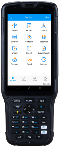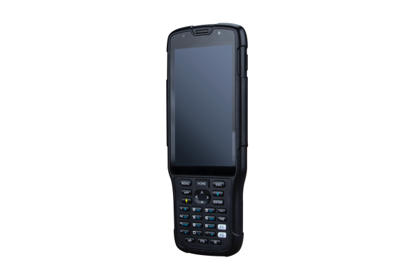
R550 Data Collector
Compared with the R500, R550 is a more professional light Android-Based data collector for field surveying and data collection.

Features
- Android 8.1 Operating System
- MIL-STD 810 G and IP67 Certified
- 5’’ Sunlight Readable Touch Display
- 13 MP Camera with Autofocus
- Compact Design with Long Battery Life
- Dual SIM and Dual Standby
- Integrated 4G, Bluetooth and Wi-Fi
Android-based gnss data controller
The SinoGNSS R550 is a professional GNSS data controller with smartphone capabilities, it has 5”sunlight-readable touch display and backlight keypad. Combined with integrated Bluetooth®, you are able to easily connect or control the SinoGNSS GNSS receivers, enhancing efficiency and productivity in the field.
Ultra-reliable in the field
The IP67 dust and water proof rating protects the R550 from most of harsh environments, and the 7000 mA Li-ion battery allows you work all day long for multiple surveying tasks. You will also benefit from its large capacity internal and up to 64 GB external storage. The integrated autofocusing camera helps you enhance job documentation by taking photos on site and sharing job information with your colleagues
Designed for flexibilities
Survey Master field software available on the R550 controller ensures you efficient survey in the field, such as topographic survey, stakeout, COGO and more. Powered by Android 8.1 operating system, you can run other third-party Apps based on your specific requirements. The R550 is also a versatile handheld featuring various sensors, such as G-sensor, Barometer, Light-Sensor, NFC, Compass, Gyroscope etc.
Technical specifications
| Physical | |
| Size | 207*84*20 mm |
| Weigh | 360g(Including battery) |
| Battery | 7000mAh, can working at least 14hours (With BT, WIFI on, and maximum brightness screen) |
| TF | Support 128G extend TF card |
| Shock | Designed to survive a 0.8 m drop onto concrete |
| Interface | USB-TypeC, support fast charge, support OTG,Bottom charging contact to support dock charging |
| Working temperature | -30℃ ~ + 60℃ |
| storage temperature | -40℃ ~ +80℃ |
| IP | IP67 |
| Shock and Vibration | MIL-STD 810 G standard, survive drop from 1.5m onto ground |
| Communications | |
| BT | BT4.1 BLE |
| Wi-Fi | IEEE 802.11 a/b/g/n 2.4G 5G |
| 4G | FDD-LTE B1/B3/B5/B7/B8 TDD-LTE B38/B39/B40/B41 TDSCDMA B34/B39 WCDMA B1/B2/B5/B8 GSM B2/B3/B5/B8 CDMA1x/CDMA2000 BC0/BC1 |
| RFID | ISO14443A/B,ISO15693,NFC :0~5cm |
| Included Accessories | |
| AC adapter | 1 |
| USB cable | 1 |
| Hand strap | 1 |
| Battery | 1 |
| Communications | |
| WLAN | 802.11 a/b/g/n/ac |
| SIM 1 | -4G: FDD 1/3/7/20, TDD 38/39/40/41 -3G: 1/2/5/8/34/39 -2G: 2/3/5/8 -CDMA: BCO |
| SIM 2 | Support GSM850/900/1800/1900 |
| Bluetooth | BT 4.0 |
| USB | Micro USB, OTG |
| Physical | |
| Working time | >14 hours (with WIFI, 3G and LCD on) |
| Standby time | 720 hours |
| Weight | >520 g with battery |
| dustproof and waterproof | IP68 |
| Shock | Designed to survive a 0.8 m drop onto concrete |
| Environmental | |
| Working environment | -10 °C to + 55 °C |
| Storage temperature | -30 °C to + 60 °C |
| Electrical | |
| Li-battery capacity | 6500 mAh |
| ROM | 16 GB |
| RAM | 2 GB |
| TF card | up to 64 GB |
| Sensors | |
| G-sensor Barometer Light-Sensor NFC Noise Cancellation Proximity-Sensor Compass Gyroscope |
|

All rights reserved by GEOiNSTRUMENTS © 2018
High accuracy GNSS technology